
Free Inquiry #2
For the first part of a lesson sequence associated with navigation, I think that starting with an introductory plan that leads up to a couple activities is a good idea.
The plan for inquiry #2 is to have an Introductory powerpoint which explores kinds of navigation in brief, then the first activity is indigenous map colouring adding place names, then third is to create their own map (with attention to map details like legend, symbols, etc.).
Firstly, students will need to think about and discuss what navigation can be.
Some example questions for discussion would be: How do we get around? How do we know where we are going?
All answers can be added to the whiteboard to make a lexical field.
Following discussion, they will discover that there are many ways to navigate. From a powerpoint presentation, I could show examples of the many ways that humans navigate on earth. This part is where I would mention historical approaches, cultural perspectives, constellation mapping, GPS, compass, tablet applications, and observational awareness. As explained in my first Free Inquiry Post, these are the components that make up the Navigation Unit plan.
I think the most familiar would be to start with paper maps as part of the introductory lesson. There would be a variety of maps that would be explored. During this time, it’s important that discussion is encouraged. I would be guiding the discussion with lots of questions and exploration of student’s anterior knowledge.
I would also include indigenous regions and explain why there are colonial made lines on the map to represent borders. I think this is important for students for place-based learning.
In my observational learning class last semester, students in the third grade pencil-coloured the indigenous regions (pre-european contact) across Canada as an activity. I wouldn’t mind doing this activity as well during the paper map lesson. The purpose of this lesson would be to explore How Indigenous perspectives deepen understanding of place and land. Objectives such as: Students will recognize that colonial borders do not reflect Indigenous territories and Students will understand that land is interpreted differently across cultures – will be explored.
This website: https://geo.sac-isc.gc.ca/Collection_de_cartes-Map_room/index_en.html could be a starting point for an upper grade level class for understanding treaties or even a regional map to understand borders version could be more simple and for all ages:
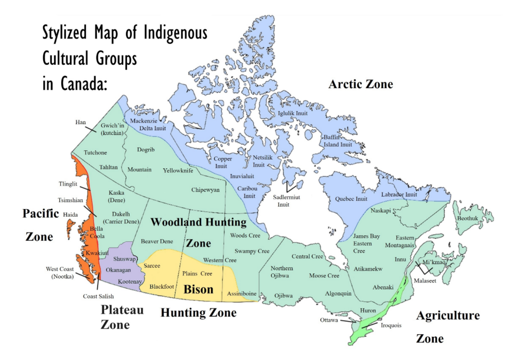
Depending on age group, they could focus on certain details. For Younger grades, it would be more colouring and writing main regions. Then, older grades would add the indigenous group names etc.
So, in our first session, the students would study existing maps and reproduce an indigenous regional map (based off grade level).
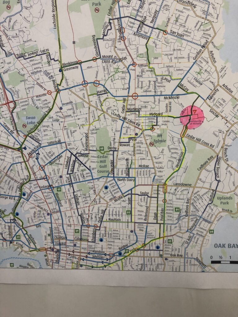
As an addition map idea (which would have to be another lesson, I think it would be interesting for students to familiarize with their local community and even bike map. Recently, I was at the UVIC library and they gave me the idea to teach in this context. Then students can highlight on the map which way they bike to school, or explore where the bike lanes are from home to school.
Then, for the second lesson, they would invent their own map and need to have specific features. This would be to promote experiential learning and help them understand the actual creation of maps.
In the end there would be time for reflection with the class and emphasis on how the skills learned from map identification and map creation will be important for future classes and the following lessons.
I think one of the main challenges with this activity is the amount of visual and written details that can go into understanding maps. I will need to be aware of how to make the lesson plan objectives obtainable and not too complex based on the grade level (once I know my practicum grade level).
I will do several save the treasure hunt/ follow the directions activities included in the upcoming free inquiry posts.
Robert, a very detailed post. If you want to do this sometime in the future, be sure to add details and “breadcrumb trails” to your sources. For example, “This part is where I would mention historical approaches, cultural perspectives, constellation mapping, GPS, compass, tablet applications, and observational awareness. As explained in my first Free Inquiry Post, these are the components that make up the Navigation Unit plan.” is a great place you could add links to ‘historical approaches’, ‘constellation mapping’, etc.